Vis/Skjul navigation
Søk
Japan
mer om dette
land
Afghanistan
Albania
Algerie
Amerikansk Samoa
Andorra
Angola
Anguilla
Antigua og Barbuda
Argentina
Armenia
Aruba
Aserbajdsjan
Australia
Bahamas, den
Bahrain
Bangladesh
Barbados
Belgia
Belize
Benin
Bermuda
Bhutan
Bolivia
Bosnia-Hercegovina
Botswana
Brasil
Brunei
Bulgaria
Burkina Faso
Burundi
Cairo, Egypt
Canada
Caymanøyene
Chad
Chile
Christmasøya
Cocos (Keeling) Islands
Colombia
Congo, Republic of the
Cookøyene
Costa Rica
Cote d'voire
Cuba
Danmark
De forente arabiske emirater
De nederlandske antillene
Den dominikanske republikk
Den sentralafrikanske republikk
Djibouti
Dominica
Ecuador
Egypt
Ekvatorial-Guinea
El Salvador
Eritrea
Estland
Etiopia
Falklandsøyene (Islas Malvinas)
Fiji
Filippinene
Finland
Frankrike
Fransk Guyana
Fransk Polynesia
Færøyene
Gabon
Gambia, den
Georgia
Ghana
Gibraltar
Grenada
Grønland
Guadeloupe
Guam
Guatemala
Guernsey
Guinea
Guinea-Bissau
Guyana
Haiti
Hellas
Honduras
Hong Kong
Hviterussland
India
Indonesia
Irak
Iran
Irland
Island
Israel
Italia
Jamaica
Japan
Jemen
Jersey
Jomfruøyene (USA)
Jordan
Kambodsja
Kamerun
Kapp Verde
Kasakhstan
Kenya
Kina
Kirgisistan
Kiribati
Komorene
Kongo, den demokratiske republikken den
Korea, Nord
Kroatia
Kuwait
Kypros
Laos
Latvia
Lesotho
Libanon
Liberia
Libya
Liechtenstein
Litauen
Luxembourg
Macau
Madagaskar
Makedonia, den tidligere jugoslaviske republikken
Malawi
Malaysia
Maldivene
Mali
Malta
Marokko
Marshalløyene
Martinique
Mauritania
Mauritius
Mayotte
Mexico
Mikronesia, føderalstatene i
Moldova
Monaco
Mongolia
Montenegro
Montserrat
Mosambik
Myanmar
Namibia
Nauru
Nederland
Nepal
New Zealand
Nicaragua
Niger
Nigeria
Niue
Nord-Marianene
Norfolkøya
Norge
Ny-Caledonia
Oman
Pakistan
Palau
Panama
Papua Ny-Guinea
Paraguay
Peru
Pitcairnøyene
Polen
Portugal
Puerto Rico
Qatar
Romania
Russland
Rwanda
Réunion
Saint Helena
Saint Kitts og Nevis
Saint Lucia
Saint Pierre og Miquelon
Saint Vincent og Grenadinene
Salomonøyene
Samoa
San Marino
Sao Tome og Principe
Saudi-Arabia
Senegal
Serbia
Seychellene
Sierra Leone
Singapore
Slovakia
Slovenia
Somalia
Spania
Sri Lanka
Storbritannia
Sudan
Surinam
Svalbard
Sveits
Sverige
Swaziland
Syria
Sør-Afrika
Tadsjikistan
Taiwan
Tanzania
Thailand
Togo
Tokelau
Tonga
Trinidad og Tobago
Tsjekkiske republikk
Tunisia
Turkmenistan
Turks and Caicos Islands
Tuvalu
Tyrkia
Tyskland
Uganda
Ukraina
Ungarn
Uruguay
USA (USA)
Usbekistan
Vanuatu
Venezuela
Vest-Sahara
Vietnam
Wallis og Futuna
Zambia
Zimbabwe
Øst-Timor
Østerrike
Tokyo
mer om dette
byen
Akita
Aomori
Chiba
Fukui
Fukuoka
Fukushima
Gifu
Hiroshima
Ichinomiya
Kawasaki
Kitakyushu
Kobe
Kochi
Kumamoto
Kyoto
Maebashi
Matsue
Matsuyama
Mito
Miyazaki
Morioka
Nagano
Nagoya
Nara
Niigata
Osaka
Otsu
Saitama
Sapporo
Sendai
Sendai
Shizuoka
Tokyo
Tomakomai
Tottori
Toyama
Tsu
Wakayama
Yamagata
Yamaguchi
Yamato
Yokohama
Gratis oppføring
Kontakter
Toyama Airport (TOY)
Japan
List of airports Japan
Toyama Airport
Informasjon om lufthavn - Toyama Airport, Japan
Beskrivelse
Verdi
IATA
(International Air Transport Association Flyplasskode)
TOY
Type
Middels lufthavn
Lokale Flyplasskode
-
GPS Flyplasskode
RJNT
Breddegrad
36.6483001708984
Breddegrad
137.188003540039
Bilder i nærheten Toyama Airport, Japan
Bilder av Toyama Airport
Informative materialer - Tokyo
Priser, Levekostnader Tokyo
Tid i Tokyo
Tidssone - Tokyo, Japan
Været - Tokyo, Japan
Kart over Tokyo
Nasjonalflagg Japan
Tokyo - telefonkode, hvordan ringe Tokyo
Bilder av Tokyo
Avstand til Tokyo, Japan
Informative materialer - Japan
Valuta Japan, Japanske Yen
Valutakalkulator Japanske Yen
Ambassader Japan
Kart over Japan
Liste over Flyplasser Japan
Fotogalleri
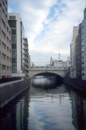
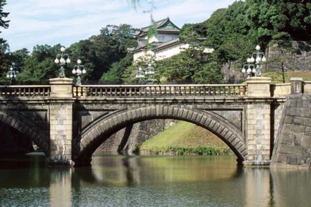
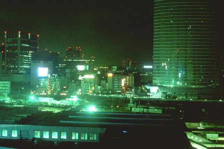
Japan, Tokyo
Legge til bildene
Bilder av Tokyo »