One of the finest balconies in Kingston. This handsome house was built in 1847 for John Fraser, merchant.

Site of Ontario's first astronomical observatory built in 1855 after a solar eclipse. Transferred to Queen's College in 1861 and a year later they had a brick structure replacing the original wooden one. It was moved to Queen's University in 1881. Some of the original equipment is on display in Sterling Hall. There were no street lights, and the trees had all been cut down for fire wood giving an unobstructed view of the night sky.

Fort Henry

Queen's University, Kingston, Ontario, Canada

This 1.2 billion year old granite inlear was burried with 460 million year old Ordovician limestone, which was later erroded by a series of glaciers, re-exposing the rock again. The limestone had the same elevation as the surrounding limestone hills. Glaciers erroded the leading face of limestone, in a SW direction, with minimal top errosion forming valleys in a NE-SW direction seen in the satellite photo.

Snow drifts get huge as snow gets blown of large fields. This snow bank was measured at 2.5 m. high ( 8.2 ft.). There was a lot of drifting off the large fields that were almost swept bare, it was not from heavy snow fall.

Bailey Broom Company factory began in 1903 and has been closed for decades. It is an example of how nearly everything we once used was produced locally. Can you get a locally made broom at Walmart?

Mid-Ordovican 470 million year old limestone shows different periods of sedimentation. The thin dark layer between the dark and light limestone is volcanic ash. The lighest colour stone is the purest carbonate rock. Silt content darkens it. Looking south. Other than some 12,800 year old glacial sediments, the top 470 million years of geological history is missing. There is a dramatic change to the sediments, for a million years immediately following the volcanic ash. What happened?

Fort Henry hill is popular for sliding, Looking south west.

Kingston Harbour as seen from the Wolfe Island Ferry in January 2014. The Great Lakes experienced 88 % ice coverage in Feb. 2014 with 95 % on Lake Superior, the greatest in over 20 years. At it's peak, only the south shores of Lake Ontario and Erie were still open. A year ago, Lake Ontario remained ice free for the first time in history. The ferry uses four 1,800 hp. engines at full thrust to get through this half m. thick slush and it has doubled it's fuel consumption.

Trinity Anglican Church built in 1845 is the oldest church on the island. There were also Presbyterian 1879, United 1924, a Methodist 1874 and a second Anglican church built in 1862 on the island. There were also 15 one room schools scattered over the island. Wolfe Island.

If it looks like an old train station with the large awnings and bay window, you are close. It is the original Wolfe Island ferry waiting room from 1919. Now a private home.

You could skate down his road. This ice was a week old, the main roads on the island were bare. The glare ice on the fields forced the Snowy Owl and other raptors to leave, they could not feed on small rodents throught this ice. About 22 Snowy Owls were observed on the island a few weeks earlier.

The ice storm Dec. 24 2013 left a 3/4 million people without power and heat. The very cold air causes Lake Ontario to steam because it is much warmer than the air. There is always a band of clouds on the south shore when we get cold north winds. The air picks up moisture from the lake and dumps snow on Watertown and along the south shore in a snow belt.

Cedar Island and the Cathcart Redoubt in January.

K&P trail built on the 1875 K&P Railway. CPR took over operations in 1901 and it was finally abandoned in 1986.

This rock fracture splits the hill in two. It is found on both sides of the road. It is fairly recent geologically, it is filled with soft soil.

LaSalle Causeway Bridge. The fore ground is the channel for the Wolfe Island ferry. The dark circles are due to a bubbler system releasing compressed air from a pipe on the river bottom. Common Goldeneye and Merganser ducks enjoyed the open water. This bridge built in 1917 replaced the penny bridge built in 1829 which replaced the cable ferry that began in 1786.

Iceburg in Kingston harbour? No, just ice piled up in mid April, 2014 on Snake Island up to 5 m. (16 ft.) thick. Some rock is exposed in the middle. Seen from 3.8 km. away. Looking SW. It only lasted a couple of days, then waves broke it up and washed it away. You can see the island in the satellite photo.

Sacred Heart of Mary, Roman Catholic Church, on Wolfe Island. The first church here was built in 1852, it burned in was replaced with a stone one in 1872. That was taken down and replaced with this one in 1916.

One layer of limestone here contains white calcite geodes. Geologists can trace elevations of rock to find hidden faults by changes in the elevation of such rocks. It also provides a link between seperate beds of rock. A layer of volcanic ash below the geodes can be seen between the dark and lighter coloured rock. This ash sometimes is found over vast areas. The rock is 455 million years old.

Fort Henry hill is popular for sliding. Looking south.

FortHenry019

One of the hospital in Kingston

P1010069

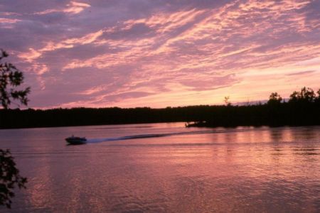
Kingston Riverboat

Kingston Waterfront

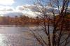
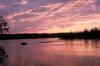
Kingston Lakeshore at Noon

Nice old house in Kingston Ont.

Herchmer-Norman Rogers passage

Looking towards Marysville, Ontario, from the ferry to Kingston

Wolfe Island From Construction Barge

Wolfe Islander Ferry

Kingston Skyline

Mil Islas

View from 1000 island cruise boat tour

Kingston

Windmill's - Wolfe Island, Ontario, Kanada

Wolfe Island wind turbines (panorama)

Simcoe I. view (panorama)

Gravel bar at the east end of Amherst Island. It almost connects to the Brothers Islands. You can follow it underwater in the satellite photo. Boaters must take great care between the islands, expecially in the fall at low water.

Iceburg? It is just ice piled on Melville shoal in Kingston Harbour. It is 3.0 km from where the picture was taken. The red roofed house behind it was 7.0 km away. With a bit of math, the ice was piled up 7.1 m (23.5 ft.) high. Looking ESE. The water is only one m. deep there, despite it's remoteness from shore. April 17 2014. The wind turbines are on Wolfe Island.

A dike was built years ago to make a Cranberry marsh on the right, now just a bird sanctuary. It barely shows in the satellite photo with thick growth of weeds in the summer.

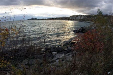
Martin Edwards Reserve. It is owned by the Kingston Field Naturalists for shore line perservation for migrating birds. Martin Edwards was one of the world's leading bird watchers who often watched here. Access is limited to KFN members to minimize disruption to wild life. Kingston is on the horizon.

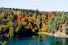
Nine Mile Point, Lake Ontario, On, Canada

Canada

Canada

The Collins Bay Penitentiary
Photos provided by Panoramio. Photos are under the copyright of their owners.